I am trying hard to catch up on the blogs. I am over a week behind. But it's just that there are so many wonderful things to see as we are traveling, it takes me a while to settle down and work on a blog each night. Between unloading pictures, combining videos into a YouTube, and just enjoying and relaxing where we are at, it all takes time.
I left off with Matenuska Glacier, and we were traveling further east. The road is a little of what you can say bumpy and wavy and undulating pavement. We worked our way over to Tok. We have been here before. This is the one section of highway that is all a repeat of what we saw on the way up. So we knew that once we got to Tok, we could pull into Northern Energy fuel station and get diesel, as well as propane, but also get free potable drinking water for our freshwater tank. And best of all--- We could do a free RV wash!
They furnish the water, the buckets, and the brush. Steve has our own preferred RV washing soap along. It was so good to get off the layers of road grime again. These things are important to Steve!
Look at that, all shiny again!
It was getting a little later in the day. So we decided to spend the night over at the Alaskan Stoves Campground again in Tok.
I reviewed this place in my blog on the way up in May:
It's a quirky place, and pretty much self-serve. We were able to catch up on laundry and refill our water tanks. Steve took a long shower over in the park building. I prefer to take showers right in our own motorhome. Then we can dump the excess water that is in the holding tank at the sani-dump before we leave the campground.
We met some interesting guys riding on Harley-Davidsons. They were called the Oneness Riders out of Surrey, British Columbia. We do meet up with them again up in Chicken, and I will include photos and more information in that blog in a few days.
Once we got everything squared away in our campsite, we were treated with a beautiful sunset along the edge of town. I was going to walk out to the edge of the campground so I could get a clearer shot down the road. But instead, I decided to curl up in my jammies and go to bed. So this is the best sunset picture that you're only going to get.
The next morning, after breakfast, we got roadworthy and ready to leave the town of Tok. But first, Steve had a stop off to make at the Three Bears store.
It's a local Alaskan owned chain of stores. In Tok they happen to own the grocery store, as well as a nearby hardware store, and then a convenience store gas station along with sporting goods. So they pretty much have it covered in the town of Tok. It also happened to be senior citizen discount day of 10% off. They were very, very busy, so Steve just ran in while I waited at the parking lot in the RV with the dog.
He has grown addicted to the marvelous chocolate chip cookies that they have, And also a particular type of cream soda that he has been enjoying.
Just look at the face of that happy man! Now he's stocked up on his favorite soda and cookies for a while.
(T-shirt is compliments of the grandchildren)
Then it was time to hit the road. We know it is really rough and rugged, just like this photo below.
Once we got out to the corner about 9 or 10 miles out of Tok we would be turning north... Towards Chicken, AK and the Top of the World Highway.
Now this is uncharted territory for us. We are now entering the Taylor Highway.
I saw this cute little log cabin, and it looked so adorable tucked away in the pines. What a great little place to escape to (if it wasn't so close to the highway). But, in terms of highway, there's relatively few cars. We're not thinking like Highway in the lower 48 states. We're thinking like one car every 10 minutes or 15 minutes like a back County Trunk road in Wisconsin. Lol!
Shortly the pavement gave way to gravel. Now the Taylor Highway was going to get a bit more challenging. Once we drive it all the way North past the town of Chicken, it would become the famous "Top of the World" highway. Combined with this Taylor Highway it's over 500 miles of some of the most rugged terrain and difficult driving surfaces.
Most of it is gravel, like this. Full of washboard and potholes and definitely no guardrails!!!
Now we are being subjected to some of the most beautiful scenery. We noticed that as we get further north, the trees are getting shorter and more stunted. Even the grass growth around the sides of the road and of the hills is shorter.
Each and every turn is bringing a wonderful new panorama view. In the lower areas we are crossing rivers. Many of the rivers in Alaska are what are called "ribboned". It's where the bed of the river is ever changing and the river is flowing depending on the volume coming down. It's always changing and making little rivulets and currents as it winds it's way along it's path.
Sometimes it flows to the left of the bank, sometimes it flows to the right. Other times during spring runoff or heavy rains it consumes the entire river bed. It sure is an interesting feature and ever-changing for the scenery.
We wound our way up very steep inclines. The views were amazing! The gravel road wasn't too dusty, because there has been rain the night or so before. Everything has a soft powdery layer from the dust. When it gets wet, it's very greasy, and slippery! I would never attempt to drive this road on a rainy day.
There literally was NO traffic coming either direction for our first 30 or 40 miles. Steve was able to stop at one spot so I could get out to take some photos way down deep into a valley. Notice, no guardrails! In some places it was a single lane and you had to be careful not getting too close to the crumbling edges.
The valley was way way way far down. This is a huge river at the bottom. The camera really can't capture the depth of this. But hearing the birds and feeling the breeze will be caught forever in my memory when I look at the photo.
It was a beautiful day, and the clouds kept making amazing formations in the sky. None of them contained any rain.
The clouds made interesting shadows across the rolling undulating hills. The colors were so vivid from sharp bright greens in the sunlight to deep muted dark rich colors in the shadows. They were ever-changing and it was a delightful array to see how many different shades of green there actually are.
After 60 miles, we really needed a break. We had looked up this campground called West Forks Campground, run by the BLM. That is the Bureau of Land Management. They accept our Federal Access Senior Golden Age passport, so instead of $12, we were only paying $6 to camp here in a rustic site. It was good to get off the road and relax.
We entered into the campground, and there were two loops. One to the left that was deeper down and all shaded sites along the river, and the one to the right were more open sites ringed around in a larger group area and away from the river. We opted to go to the right and camp where it was easy access to get in and out.
Of course, there is absolutely no cellular signal here and there's no way to use a credit card. Be sure if you come this way you have cash or a check. They have a pay station with envelopes. You write out your information and drop it in with the exact amount needed. There is no change. There was a campground host nearby for assistance. But mostly, you are on your own. We always are sure to carry a variety of bills in different denominations so we can pay for campground fees as needed.
We got set up on a nice site in the shade but also had access for our Starlink to the sky. The best of both worlds.
Nick seems to think this is a pretty good campground too. But after all, he thinks any campground is good if he can get out and sniff.
I've talked on some of my YouTube videos about fireweed. The plant that grows native along the road sides in abundance all summer long in Alaska. It's bright pink blooms are absolutely beautiful. As the blooms open up along the long pointy stalk, it's in an upwards fashion. The lower blooms open first and it works the way up the stalk. Legend is that once it reaches the top it can be as few as two more weeks or as many as six more weeks until snow flies. Depending on which website you read. Lol. So once the blooms on fireweed climbs to the top, you better get the heck out of Alaska and heading south if you don't want to be stuck there for the winter.
“The traditional story with the fireweed — and apparently this might go back to Native folklore or earlier — is that when they bloom out to the top, it’s six weeks till winter. They start blooming from the bottom, and they can still have flowers to the top, but after that, we should get ready for winter.”
So we will follow its advice, and start heading south as soon as we conquer this Top of the World Highway!
Here's the YouTube that goes along with today's blog:
We decided our next adventure would be trying to spot some whales at Beluga Point on the Turnagain Arm. We looked up the tide tables and planned a visit to the lookout point at high tide. That's the best time because they come in with the tide chasing the fish.
We packed up and left Tenderfoot Creek in plenty of time after breakfast. It was a cloudy icky looking day, as we drove east and north up to the Turnigan Arm. We made a quick stop again in Girdwood to partake of their free potable water faucet over by the fire station. We also popped into their little grocery store and restocked with items that we were low on. That way we didn't have to battle any of the big stores in Anchorage later that afternoon.
We headed north on the Seward Highway and worked our way up to the Beluga Viewing Point.
We found a great spot to park the motorhome and started watching out of the windows from the warmth inside. It was windy and damp outside.
We looked and looked for about 2 hours. A lot of other vehicles stopped and looked and took pictures too. But nobody saw any whales. It was noted that yesterday there was a female and a calf that were in the area. But today they were nowhere to be seen. Guess they didn't want to come back with the new tide.
While waiting, we also cooked up a nice lunch of tacos. Steve browns up the hamburger meat and I cut up all of the other ingredients. Then we kind of leave it set out like a taco bar, and assemble each to our own preferences.
Actually, the tide started rolling out. We put away our stuff from making lunch and decided to tackle getting through Anchorage before rush hour.
The problem with driving through Anchorage is there are no bypasses or alternate routes. It's one highway right through the smack dab middle of town!
We managed to hit the major part of town about 2:00 p.m. That wasn't so bad. It was more like driving through the middle of Green Bay with lots of stoplights and lots of chain stores and lots of crazy drivers pulling out right in front of you.
Some really dark storm clouds were rolling in and it looked like it was not going to be a very pleasant afternoon.
We headed on further east on the Glenn Highway. We made it through Palmer and headed further east into the beautiful mountains of the Chugach National Forest. It felt so good to be up in the mountains again and out of the crowds.
Make no mistake, we are glad we visited the Kenai Peninsula and went all the way down to the Homer Spit. But the tourist crowds and the traffic was not to our liking. We really enjoy getting back out into the quieter areas. As we head further east, the traffic lightened up and we were soon traveling along admiring all the scenery on both sides of the road.
The next stretch from here to Tok is going to be a " repeat" for us of doubling back on the route we had originally come in on. It is about a 300 miles stretch, where we will basically see the same things. But Steve said we'll be seeing them from a different angle because we'll be coming from the opposite direction! He has such a good outlook.
We drove on through Chickaloon, which is the area where we got our windshield chip on the way west. No chips this time! It was flat clear pavement and no gravel when it happened. Figures. An oncoming car kicked up a rock and we got it right in the windshield last time.
We drove as far as Matanuska Glacier. We had stayed here on the way West and we figured it would be a good spot to stay again on the way east. It's a state recreational area and cost $25 a night. They are beautiful individual sites tucked into the woods and you don't see the next camper because of the heavy brush and tall trees. There are outhouses and a pitcher well pump and a dumpster. There are no hookups, but it's right next door to the big glacier viewing deck which is a plus.
We got settled in for the night after a long day of driving. We also pulled out the maps and went online and figured out more about our route home. We are looking at taking the Cassiar Highway and having less doubling back on the same routes. The dark blue line is our route that we had already taken. The lighter turquoise line is our proposed route home...
The next morning, the rain was gone! We were excited that we were going to actually see Matenuska Glacier from the viewing deck with good clear skies!
Can you imagine waking up, pulling up the shade and looking out the bedroom window at scenery like this?
This is the kind of camping we enjoy, compared to parking in a lot like we did down in Homer! The birds were singing and the sun was peeking through. It's time to get breakfast cooking and head over to the viewing platform and see what we could see of the glacier...
WOW!!!!
The morning lighting was perfect. The glacier seemed to be glowing white as if it were all fresh brand new snow. Actually, this glacier is 30,000 years old.
The sun was up and warming the chilly air around us. It was so beautiful to sit on the viewing platform, all alone, and watch the morning light spread across the valley.
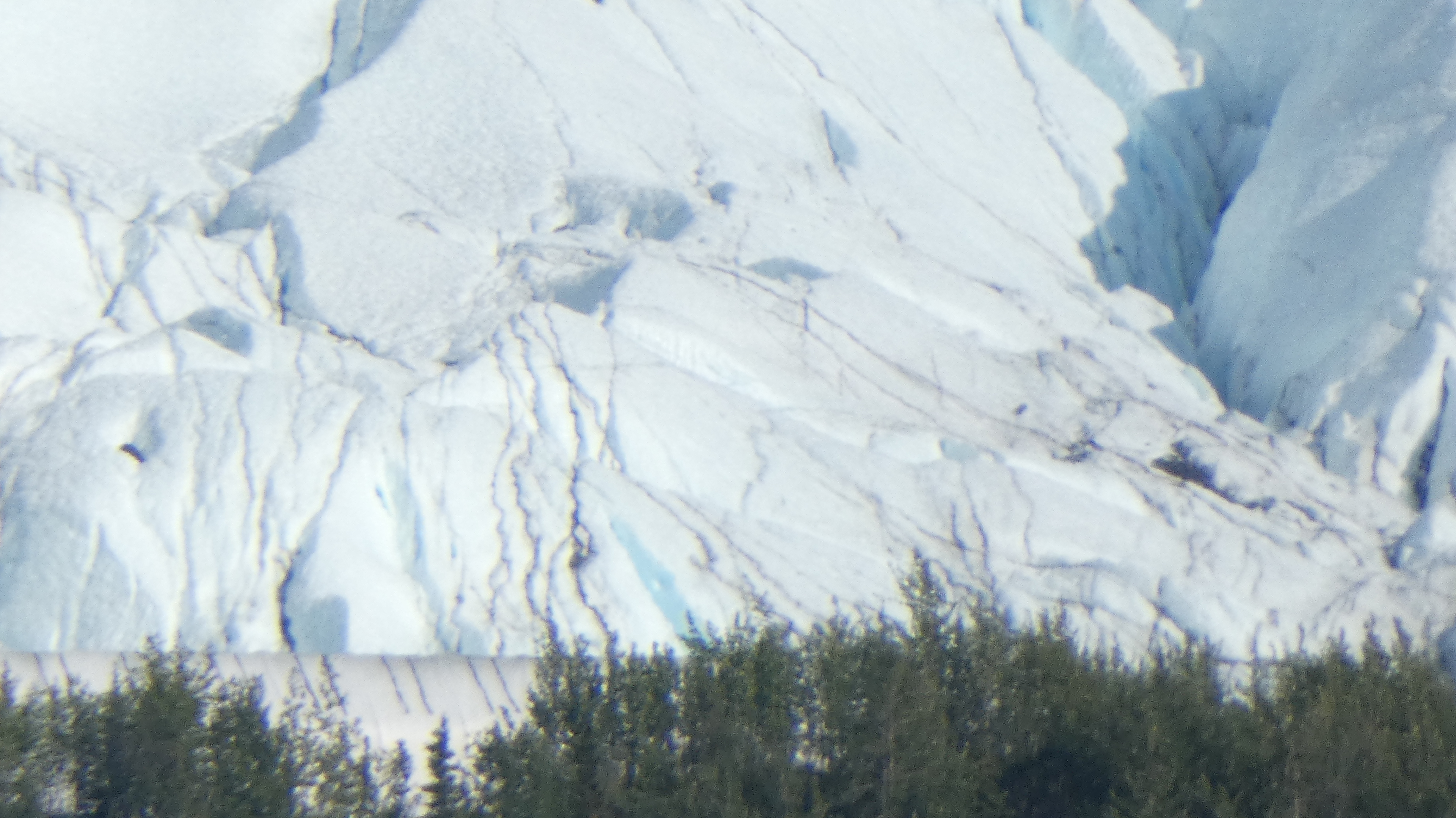
How many times have I said how much I love love love my camera? Steve bought it for my birthday just specifically for this trip. I was able to zoom in and really catch the details of the ice on the glacier.
What is amazing is that this glacier looks so fresh and clean and white. The clouds passing overhead made it look gray in the back section, but they were rolling back off the mountain sides and clearing the way for a bright sunshiny day.
As I zoomed in, I could see the craggy ridges and peaks of the glacier. I could not imagine ever trying to traverse such a thing. It's like you would be mountain climbing over every little ridge just to go a short distance.
I am in awe of how close this camera can get me. It's like seeing the details and not having to cross over dangerous terrain to get to experience the textures and the facets of the glacier. It's amazing to watch the sunlight dancing off the various parts and planes.
It's a shame that these glaciers are melting so fast. Too fast. They are rapidly receding. I wonder what's going to happen next with this type of natural resource?
Steve had his binoculars, and I had the camera lens to let my eyes play over the different areas of the glacier. It was amazing to see how this huge slab of ice is crumbling and sliding forward over the centuries. And now it's melting and receding.
I know I know I know, how many pictures can you take of a stupid glacier?
But the way I look at it, it was the one and only time I was going to be standing in this particular spot, with my camera, looking at it. Why not preserve it in my memories with a photo? Or lots of photos?
I think that sadly, someday, this will all be gone. I'm so glad that we have the opportunity now to see it. It may just look like a photo of some chunks of ice next to a mountain. But in reality it is humongously huge, and I am in awe.
Here's the video that goes along with today's blog:
We grudgingly left Skilak Lake. We really didn't want to. It was so nice there. But I think it was time to get moving.
The traffic was increasing once we reached the main highway. The 4th of July people are out and about in full force. The weekend before the 4th and the weekend after the 4th brings out a lot of people who take that precious week off of work in between.
We understand the joy of having vacation and hitting the campgrounds. We did it too with a family with four children. Usually our kids invited extra friends along, so sometimes we had six or seven! So we know all too well the noise and the hubbub that a large group can bring on every campsite. So it was good to get moving and go find something quiet and out of the way.
We drove along the Sterling Highway, and had our eyes set on another little quiet out of the way place. It was called Tenderfoot Creek and it was on a little lake called Summit Lake. I figured we would try to roll on in and see what we could see.
It is part of the Chugach National Forest and we like camping in their types of campgrounds. We get half price camping with our Federal America the Beautiful Senior Access Pass.
We drove on it, and the mountains were higher than the clouds!
Campsite number 1 was open when we got there and looked pretty good. It was a drive-through site which makes it even easier to get in and out. We did a complete loop through the campground and most of the sites were taken or reserved. So we looked back to site number one and pulled in.
The only real problem is that the surrounding brush and woods are completely filled with a form of noxious weed called "cows parsnip".
Heracleum lanatum Apiaceae/Carrot Family
Cow Parsnip grows in moist fields, woodlands and alpine meadows. It is a tall (5-8') plant with large hollow stems and very large maple-lead shaped leaves that are deeply divided into three. The leaves and stems have conspicuous hairs. The leaves have a striking resemblance to the Devil's Club, another understory plant of Alaska, but Cow Parsnip isn't covered in thorns. The flowers are tiny, white, and arranged in flat-topped clusters at the top of each thick stem. If you find this plant while hiking, be careful about brushing against it because the juices (and compounds called furanocoumarins) react with sunlight, especially in people with light sensitive skin, and cause blistering. If you do get the juices on your skin, wash it off as soon as possible.
Steve is severely allergic to wild parsnip in Wisconsin, so we are pretty sure he would be allergic to this too. Even just busting off one branch and letting the juices touch his skin can really mess him up. I believe it becomes what's called systemic and gets into his system. It spreads inside through his body and crops up in other places externally. He had experienced this when he was working at High Cliff State Park mowing it down with the big flail mowers. Anywhere that his skin was exposed where the juices hit, he was in severe distress. It was so bad he ended up going to the hospital! It took weeks and weeks and weeks for the weeping blisters to finally heal over and probably a couple months for the scarred and discolored skin to fade away as it healed. So we never want to deal with that again!!
It was kind of a rainy misty evening, so we really didn't need to be outside anyhow. He did take one loop walk around the campground the next morning, but didn't touch any of the weeds and stayed in the middle of the road!
Our campsite itself, around the picnic table and fire pit were well maintained and cleared of any of the weeds.
We supplement the heat during the day with this Coleman sport cat propane heater. It's a catalytic type and doesn't use any electricity or battery power. It really takes the dampness out and we have it set on a table centrally located in the motorhome. The less draw on the batteries during the daytime is good, And then at night we run the big propane furnace and turn this unit off.
It was a wonderful warm and cozy night...
We slept peacefully and listened to the pitter-patter of rain on the roof of the motorhome. That's good, because the area does need rain. Considering all of the wildfires to the north, I hope that they got a large abundance of it.
When we woke up, the lake was as clear as glass. Over on the other side we could see some cute little cabins that are available to rent from Summit Lake Lodge. How beautiful.
Steve needed to refill the 1 lb canisters of propane that he uses for that sport cat heater. I wrote about this in another blog a while back. It's a refill kit from Mr Heater and he can refill them from that one gallon propane tank that he uses for the grill. He also bought two of the refillable canisters from Mr Heater that have a special valve to help him fill them up. They are made to be refilled over and over. He used to refill the green disposable or throwaway ones, but after a while the little rubber ring in there wears out and they leak gas. This is much safer.
Here's the little walkway that leads over to the tenting area. People who rent the tinting campsites parked their cars on one side of the bridge, and then cross the little babbling brook to the tenting sites on the other side. How cute is that?
Now for some deep thoughts....
Now that we are past the halfway point of our Alaskan adventure, it's time to reflect on a few things.
We are having the Trip of a Lifetime, and enjoying the adventure through and through. Even though we have now turned around to start heading in a homeward direction, it doesn't matter, because it's still an adventure.
Most of our route home, like I said, will be on a different route then the way up. That makes it more exciting --- because we will get to see different things.
Traveling-wise, we are very comfortable in the motorhome for months on end. We really have it set up quite well and have planned equipment in advance. As long as we find locations for dumping tanks, taking on freshwater, and finding propane fills, we are fine.
Diesel fuel is available at almost every station we stop at. Especially the diesel #2 that we use. Rather than some of the modified biodiesels that we are seeing down in the lower 48 states. Our Mercedes engine really does not like that type. We look for diesel #2 as much as we can when we are traveling in the lower 48. It seems that up here in Alaska, we haven't seen any of that bio junk. Everybody wants regular good diesel #2. That's fine with us.
Organizational-wise, we do miss pulling the cargo trailer behind us. We usually do that in the lower 48. We opted to not take it along on this trip because of the degree of ruggedness on the roads. Everything back there would be so tossed around it would be hard to imagine things not getting damaged. The cargo trailer carries our two e-bikes, all of Steve's extra tools, and things like extra sitting lawn chairs for guests, folding tables, camping rug etc. The center aisleway is usually stacked up with totes of firewood or wood pellets for our pellet burning fireplace. Yes, that's in there too. On the shelves in the cargo trailer we carry things like my air fryer, my electric pressure cooker, our big Blackstone griddle as well as other external cooking gear. We have things along like an electric chainsaw, extra extension cords, and solar panel equipment. The roof of the cargo trailer has a 320 watt solar panel on it. We can use that to charge up our Bluetti power station or hook it directly to the motorhome camping batteries and charge them at the same time. What is really nice is we can unhook the cargo trailer and push it off into a sunny area, while we still park the motorhome in a shady spot. So those are all the benefits of having the cargo trailer along. And we do miss it. But I think for this type of trip, it was best to leave it at home.
Connectivity-wise has been just wonderful having our Starlink along. We are able to connect and remain in contact with our families. The grandchildren text us all the time. We are able to send photos back and forth. And essentially we are able to update our children to reassure them we are safe and alive. Two old cronies like us bumming around 5,000 miles from home makes them a little worried about us. So having constant contact and being just a second away of a keystroke on a computer or a touch of a cell phone makes it really nice. Both of our cell phones are set to Wi-Fi calling and they are able to call through the Starlink.
Financially, I keep pretty good records through a spreadsheet and recording all of our receipts and dates and whether we used a credit card or cash. While using our credit card in Canada, it is all immediately converted over through the exchange rate to the United States funds. Also at the border we transfer some cash over into Canadian currency to use while traveling throughout Canada.
I am pleased to say we are well under budget and have not overextended ourselves for this trip. We've splurged a little here and there, but most of all the things are about what we expected. Even the grocery stores are not nearly as bad as what some people proclaim. A few of the fuel stops have been a little higher in price, but we knew that going into this because those places pay more to get the fuel brat there. These little mom and pop places that are on the route along the Alcan Highway or the Klondike Highway are making their money in a short 3 months out of a 12-month year. We don't be grudge them their profit. If they didn't make any money, they wouldn't even be there and we would have no fuel at all!
As far as adventure and sightseeing, we love the natural beauty and looking at the landscapes and the textures and the terrains. As you can tell by now we don't do the tourist things, we don't go for crowds, and we avoid tourist traps like the plague. We don't do restaurants very often, and we enjoy cooking out in our own campsite and looking at the scenery while we do it.
Overall, I think the best part of this adventure is that we are together.
We are enjoying the scenery, exploring new places, and seeing things that neither one has never seen before. We enjoy each other's company and we are best friends. Do you know on this entire trip we have not turned on the radio once? We spend our time talking and pointing out things that we see. We are soaking it up and preserving the memories in our minds and our hearts. Plus we are preserving them on film as best I can. Actually right now as I am narrating this text into my blog, a big moose was on the road! I was able to drop the cell phone, grab the camera, and film it as well as snap some still shots. They will show up in a future blog.
Most of all, we are just soaking this in and enjoying our travels.
Here is the YouTube video that goes along with today's blog:


.JPG)


.JPG)
.JPG)
.JPG)
.JPG)
.JPG)
.JPG)


.JPG)

.JPG)







 Posts
Posts

